Wednesday, June 30, 2010

San Vicente Pacaya and the Volcano

Due to the tragic incidents occurred just a month ago,  I had to think more than twice about including the San Vicente Pacaya municipality in today's post. To be honest, after the tremendous explosion of the Pacaya Volcano and just a couple of days after that, the flooding caused by the heavy rains poured during the Agatha Storm over the central valley still covered with a thick layer of volcanic residues, made me wonder if I should just skip talking about the Pacaya area. Not knowing how damaged is the town, the villages nearby, and the surrounding natural attractions, including the Caldera Lagoon, made me feel unconfortable about today's post. Not withstanding my reservations and overcoming my hesitation, I decided to feature Pacaya.
I wouldn't like to seem disrespectful and sincerely hope that everything is returning to normal for the people in the area, my best wishes are with them for speedy recovery.
This recovery brings me back to  the possibilities that many of Guatemala's regions could benefit from tourism. I will keep stating that tourism is a great way to improve everybody's lives: while travelers enjoy and learn, locals promote and sell their products or services.
Even after last month's explosion, the Pacaya Volcano National Park continues to be  the municipality's main tourist attraction. The volcano is actually a complex of several active volcanoes, only 30 kilometers east of Guatemala City.
For years, it has been a popular volcano to climb because I know for a fact that it wasn't too difficult and, on sunny days, the views are stunning. Again, I don't know the current conditions and am not even sure that the park is open for climbing excursions.
The Pacaya volcano is  part of the Central American Volcanic Arc, a chain of volcanoes stretching from the northwest to the southeast along the Pacific coast of Central America, formed by the Cocos Tectonic Plate beneath the Caribbean Plate. The volcano lies on the southern edge of a sizable volcanic caldera formed in the Pleistocene age which contains Lago de Amatitlan.
After the last caldera-forming eruption 23,000 years ago, several smaller vents within and around the caldera have seen eruptive activity. Pacaya is the largest post-caldera volcano, and has been one of Central America's most active volcanoes over the last 500 years.
About 1,100 years ago, the volcano's edifice collapsed, causing a huge landslide. Deposits from the landslide traveled about 25 kilometers (16 mi) from the volcano down to the Pacific coastal plain. The landslide left a large crater, within which the current active cone has grown. The presence of a magma chamber at shallow depths beneath the volcano means that distortion of the cone leading to instability and future landslides remains a hazard to the surrounding areas and considering  what happened a month ago, it would be expected that those towns are relocated to safer areas, after all, there is nothing we can do against the forces of nature.

Tuesday, June 29, 2010

Pa'laq ja' -The Standing Water-

Pa'laq ja' is the land of the Maya Poqomam descendants and remains as one of the few municipalities in the lowlands where ancient traditions are still observed, and the only one in Escuintla where women wear the typical costume. This is Palin.
The name in Poqomam that translates as "standing water", is a reference of the town's location: right on the slopes of the Agua Volcano. The current name, Palin, is a Nahuatl-origin voice that translates as "place of strong winds" and is a reference of the windy phenomenon that occurs from November to February.
The area is surrounded by intense volcanic activity, so there are several places with thermal and sulfurous springs and swimming pools.
One of the main features of Palin that I remember the most, is the enormous Ceiba Pentandra tree (Guatemala's national tree) in the center of the central plaza, which according to the records, was planted during the founding of the town on July 30, 1535.
Before the new toll highway was built, Palin was a stop in the route to El Puerto (the beach). That stop had the purpose to buy fresh produce and fruits whose aromas seemed to be floating under the ceiba shade. Right now, I am thinking of the big, almost flat baskets full of anacates  displayed over bright green banana leaves (anacates are yellow umbrella-like mushrooms, related to the better known chanterelles)... What a treat! A chunky and simple anacates sauce poured over a tenderloin steak is like heaven.
Since the opening of the toll highway, Palin is no longer a regular stop for people going to El Puerto and the market is no longer open-air under the ceiba; even though, Palin continues to be an interesting place to visit.

Monday, June 28, 2010

Escuintla: Guatemalan Lowlands Heart

Welcome to a new department in the lowlands: Escuintla. A name that brings me joyful memories from times spent with my family and friends. A name that always makes me think of that candid image of the Resplendent Quetzal painted over the rocks on the road somewhere close to Palin, one of  Escuintla's municipalities, which has been there since I can remember...
The innumerable rivers crossing this department contribute to the fertility of its soils; and the beautiful mangroves bordering its coast, have been declared an ecological reserve zone. It is one of the most active tourist sites in the country and a favorite for city dwellers many of whom own  beach-side vacation villas.
Its current economic prosperity comes from the exploitation of large extensions of land in the cultivation of sugar cane and livestock ranches. The modern Puerto Quetzal and its intense activity also contributes to the prosperity of this Department.
On average, the altitude in Escuintla is 350 meters above sea level and it bounds to the north with the departments of Chimaltenango, Sacatepequez, and Guatemala; to the east with Santa Rosa; to the west with Suchitepequez; and to the south with the Pacific Ocean. This department is divided into 13 municipalities, and its capital is also named Escuintla.
The slopes of the Volcanic Chain are humid and the moist clouds provide a constant rain that makes the area a true tropical rain forest,  home to  micos (Callitrichidae -synonym Hapalidae- also known as New World monkeys), ocelots, weasels, and other species.
The extensive seashore is composed of gray sands of  volcanic origin, interrupted  only by the mangrove forests and channels which provide an excellent habitat to fiddler crabs, pelicans, seagulls, beach scavengers, and robust stolon grasses..
Other interesting attractions in this area are: the Guacalate River Canyon, the Pacaya Volcano, the caverns and waterfalls of San Pedro Martir, and the archaeological sites El Baul, Bilbao, and El Castillo.
The well maintained  road network makes traveling through and across  Escuintla  very easy.  Some of the most important roads are: Hwy  CA-9 (the Inter Oceanic Road from south to north) and  Hwy CA-2 (the Pacific Road from west to east). These and several secondary roads are located  along the route we will follow in the days to come when we  will explore this rich, diverse, and fun-filled department.
 All the images in today's post are from galasdeguatemala.com, used with authorization.

Friday, June 25, 2010

Festivals and Celebrations: Carnival in Mazatenango

Without question, throughout Guatemala the biggest celebration of the year occurs during Holy Week when every town and village hosts elaborate processions where images of the saints are paraded through the streets and accompanied by musicians playing traditional songs of both Maya and European origin.
In many places, elaborate carpets, painstakingly constructed of colored sawdust and fragrant flowers, cover the major avenues only to be destroyed by the passing parade.
Carnival is also among the important celebrations and becomes a massive party in places like Mazatenango, where it is really a big deal!
Each municipality and village also has their own yearly festival, usually held on the day of their patron saint, when all the residents, dressed up in their finest clothing, converge upon the plaza where games, exotic foods, music and the crowning of the new queen all contribute to making the ocassion special.

Thursday, June 24, 2010

The Beaches at Suchitepequez: Unexploited Potential

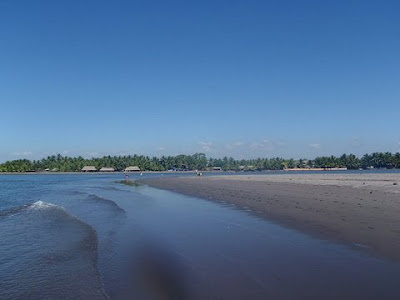
Thanks to several river mouths along the coastal line, Suchitepequez is probably the department with more beautiful beaches in Guatemala. The tide is less impetuous and the sand is finer and lighter.
I would like to be able to share with you interesting and valuable information about other regions in Suchitepequez, but this time, I found myself without so much to say. 
Since the whole area has not been developed yet in terms of tourism, and while living in Guatemala, most of the time I only passed through Mazatenango on my way to some other places, my personal experiences there, are limited. So,instead of writing, today, I invite you to take a look at these images. I hope they  motivate us enough for all of us to visit this pristine region real soon.
 

Wednesday, June 23, 2010

The Mountainous Side of Suchitepequez: Santa Barbara and Los Andes Reserve

This is the municipality of Santa Barbara and I don't exaggerate when I say that what we are going to discover today is a hidden treasure.
Los Andes, a Private Nature Reserve, located on the western chain of Guatemala’s volcanoes, is among the first cloud forests dedicated to the protection of the Resplendent Quetzal (Pharomachrus mocinno), whose courtship and nesting activities attract birdwatchers from around the world to the Reserve.
Los Andes is also home to the rare cabanis tanager (Tangara cabanisi). This small, blue, exquisite bird’s habitat is shared by hundreds of local and migrating species, including a host of hummingbirds, orioles, flycatchers, trogons and motmots.
The Reserve works closely with the residents to promote self sufficiency, health and education and the most important accomplishment is that they are being successful with a method that goes from the traditional education of repetition to an education of understanding, which is clearly reflected in the school’s slogan “Learn, achieve and share”.
The unique biodiversity of the Reserve, including wildlife, has tremendous potential for Eco-tourism and local residents are being trained as guides to provide them with an alternate source of income, and that is why at Los Andes we can enjoy a variety of activities including bird-watching, explorations through the coffee and tea certified sustainable plantations, the botanical garden, and through the cloud forest to admire more than 50 species of exquisite orchids. For the adventurous, Los Andes Reserve also offers a river adventure and hikes to the top of the beautiful Volcano Atitlan.
The core of Los Andes, of course, is The Quetzal Project, an initiative started by Dr. Anne LaBastille back in 1968, when she first visited Los Andes and worked on a Quetzal research project. The result of this was an article published in the January 1969 edition of National Geographic. She also created, in 1972, the first Association in Guatemala dedicated to the conservation of this magnificent bird, making Los Andes the first protected area officially declared in Guatemala for the protection of the Quetzal.
Artificial nest boxes were designed by Dr. LaBastille in an attempt to reduce the mortality of nesting quetzals, whose nest trees and stumps often fall down. The boxes were placed in the cloud forest in safe locations and eventually were accepted and used by a few birds,  a method that is still in use today! This elusive bird can be better observed during  two distinctive seasons,  from November to January and from April to June, which is the nesting season.
Los Andes Nature Reserve certainly is an area in which agricultural production, human development and environmental conservation are carried out in a harmonious and sustainable manner, for the well being of present and future generations.

Recommended Reading:
Lista Comentada De Las Aves De Guatemala / Annotated Checklist of the Birds of Guatemala (English and Spanish Edition)

A detail of Dr. LaBastille work in Guatemala and other parts of Central and South America.

Monday, June 21, 2010

Along the Coastal Road CA-2: Suchitepequez

As you may have noticed, our journey through the coastal plains is taking us from West to East, in a big loop that eventually will take us back to Guatemala City. Our first encounter with the Pacific Ocean was at the Manchon Guamuchal biological reserve, which defined the end of the Highlands and the starting point of the Lowlands.
During the past days, we explored some of the Retalhuleu's attractions and today, we are going to start our journey through the department of Suchitepequez, an indigenous voice that translates as Flowers Hill (I couldn't find the true origin of the name because in addition to Spanish, the Maya origin languages K'iche, Tz'utujil, and Cak'chikel are spoken in this department).
The capital city of this department is Mazatenango, which represents the general conditions of the area: prosperous, modern, self sufficient, and joyful, is better known among Guatemalans for the celebration of Carnaval (Mardi Grass-like celebration), one whole week before the lent season. 
To be honest, the commercial activities are so important for the inhabitants that they have shown very little interest in the natural wealthiness of this department, which by the way, is extraordinarily rich: from tranquil rivers and ponds to the impetuous Pacific Ocean.
For instance, the municipalities of Patulul and San Juan Bautista have abundant creeks and pools along the Madre Vieja River basin, while the municipalities of Santa Barbara, Chicacao, and San Miguel Panan have similar attractions along the Nahualate River.
Almost every one of the Suchitepequez municipalities have natural attractions, and with a few exceptions, most of them don't have the appropriate infrastructure to be considered tourist places, especially for the foreign visitor.Nevertheless, during the next days we will explore the surroundings to discover some of these pristine spots through small towns, rivers, mountains and along the 18 kilometers of fine gray sand beaches. I hope you will join us in this new adventure.
In case you didn't notice, our good friend Maynor Mijangos from galasdeguatemala.com is back. Thank you Maynor for the beautiful images.

Friday, June 18, 2010

Champerico: A Picturesque Town on the Pacific Shores

Guatemala is not exactly known for its sandy, oceanside stretches. Void of ritzy, glamourous beaches where resorts and beach facilities hog the scene, Guatemala instead maintains coastal stretches that give visitors the real experience. 
When you think of it, that’s the beauty of a place like Champerico and some other beach areas nearby. Plenty of beaches around the world offer all kinds of amenities and fanfare, but sometimes it’s nice to find a place with more original character. Guatemala’s Pacific Coast is a relaxing place, ideal for escaping the cities and highlands for a bit.
In general, Guatemala's beaches are mostly about soaking up some rays and letting the crashing waves soothe your inner soul. Due to the volcanic nature of Guatemala, all the beach areas have dark sand, ranging in colors from brownish to black, which can heat up pretty quickly in the daytime sun.
From the beginning to the end, Guatemala's Pacific coast is almost a uniform long beach stretch, separated only for the mouth of the many rivers that end at the Pacific Ocean. Not a single bay! and that is why the tide is really strong with equally strong undertows, so wading out much farther than knee-deep is something everybody should consider twice, including the accomplished swimmers. On the other hand, being the beach quite wide, it is easy to enjoy long, languid walks.
So, as a beach destination, Guatemala might not be appealing for everybody, especially for those who think of the beach as white powder-like sand, blue crystal-clear water, and soft whispering-like waves...
Champerico and other beach-front villages nearby, are fishermen settlements, which means that we will enjoy fresh and delicious seafood, caught, cooked and served by locals, who after all, are the best part of our journey: kind, warm, smiley, eager to assist you in any way, making sure that your experience will be another memorable excursion.

Thursday, June 17, 2010

Reu: The Capital of the Department of Retalhuleu

Between diminutives, nicknames, similar names and even names that are exactly like others, remembering the names of the more than 300 municipalities throughout Guatemala is quite challenging-ish... In this case, Retalhuleu is the name of the Department and its capital city; to differentiate one from another, locals call Retalhuleu's capital: Reu. And to enter Reu we are going to pass through a nice long boulevard flanked by tall coconut palms that make us realize how close to the Pacific Ocean we are.
We could say that Reu is by far the most gorgeous city in the Southern Coast region. Urbanistically speaking, it was well planned and designed and locals are so proud of what they have accomplished, that their efforts can be appreciated almost wherever you go.
Reu and its people have that exuberant personality so typical in the tropical close-to-the-beaches towns: from good mood, joyful expressions, loud music, to a sense of laid-back attitude.
Since it is hot outside, I propose a visit to the Archeology and Ethnology Museum where we will admire many of the ancient and invaluable pieces recovered from the excavations in Tak'alik Ab'aj and the surroundings.
In addition to the historic treasures, in the second floor of this museum we will find an extraordinary collection of photographs that show the different development stages of Retalhuleu throughout the years.
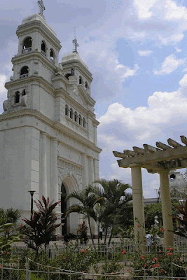
A visit to the Saint Anthony Church is worthy as well. The architecture is beautiful and even though the original retablo is not there anymore, the place is well preserved. The best part is that we can go upstairs to the bell tower from where we will contemplate magnificent views of the city and in the horizon, the Pacific Ocean.
At the end of the evening, when the sun is descending and the fresh coastal breeze can be felt, we will see how the streets seem to be busier and cheerful, as a prelude to our trip to the beach tomorrow...

Wednesday, June 16, 2010

Digging Into the Past: A Maya Royal Tomb

Today's story is based on the field notes from photographer Kenneth Garrett while covering an important archaeology discovery in Tak'alik Ab'aj in 2004. The best, he said, "for the 20 years I've worked in the Maya world I've wanted to include Takalik Abaj in a story. Unfortunately, it never quite fit into what I was doing. But with the site representing a thousand years of Olmec and Maya civilization—the dawn of the Maya era—and [Guatemalan] archaeologist Christa Schieber de Lavarreda's discovery of one of the earliest Maya king's burials, we had all the elements in place to focus on the area."
Kenneth Garrett also said that the worst was when he left the place because "I knew we didn't have space to develop a bigger story, but the worst part was leaving before I could explore other things related to Takalik Abaj. It would have been good to stay longer and learn more about the trade routes into the highlands and along the Pacific. I would like to have learned how the Maya power centers moved into the lowlands, making Takalik Abaj less important after it had been a great commercial and religious center. But we wanted to keep the story focused on the site inside the protected national park.
Until now, the excavation continues and the archaeologists team continues to find amazing remnants of this equally amazing civilization.
So, with that being said, here are Mr. Garrett's notes and some of the wonderful images he captured during the process back in 2004.
Foreman Marvin Castillo beholds a freshly unearthed staircase at Takalik Abaj, an ancient Maya city in southwestern Guatemala, as excavator Pedro Gonzalez looks on. Stairways carried residents up and down the slopes at this urban center, built more than 2,000 years ago on ten natural terraces in the country's piedmont region. The city's early Maya phase ended about A.D. 200. "Takalik Abaj became important again long after its decline," says project co-leader Christa Schieber de Lavarreda. "People here continually remodeled buildings and relocated stone monuments sculpted in former times, a practice that continued until A.D. 1000. "
Centuries ago a Maya artisan carved a stela, or stone monument, with a highly stylized rendering of a serpent ascending from the water to the sky—a powerful image in Maya mythology. "The hallucinatory visions central to Maya ritual were symbolized visually by a rearing snake," wrote epigrapher Linda Schele. More than 270 monuments, largely from the Maya and earlier Olmec civilization, dot the landscape at Takalik Abaj, where a team recently discovered the unlooted grave of an early Maya king deep inside a ceremonial building. 
Schieber stoops to drink from an aqueduct that delivers fresh water from the site's higher terraces to the north. Most of the building erected by the early Maya to sanctify the water system have disappeared, though the network of aqueducts still provides potable water to the nearby village of El Asintal. The project's team, led by archaeologists Schieber and Miguel Orrego Corzo, found this section in a small ravine obscured by a thick cover of subtropical vegetation and named the spot El Escondite, or "the hidden place."
The original article was published in National Geographic in May, 2004; if you are interested, there is an excerpt available in the magazine's Website.
Recommended reading:

Maya Archaeology 1: Featuring the Ancient Maya Murals of San Bartolo, Guatemala Chronicle of the Maya Kings and Queens, Second Edition (Chronicles)

Tuesday, June 15, 2010

Tak'alik' Ab'aj: Archaeological and Natural Treasure

The millenarian history of Tak'alik Ab'aj is one of the most fascinating of Mesoamerica. The traces of the remarkable events that occurred at this site and how they affected the evolution of the cultures throughout the region have been found by the archaeologists in the remains of the materials, artifacts, monuments, and structures left by the early inhabitants: from massive monuments sculpted in stone, sacred buildings made of clay and faced with cobbles, ceramic vessels to stone and obsidian tools.
Even though only a very small portion (less than 10%) of the site has been excavated, the study of what has been found reflects the changes in styles and technology, and some of the skills and intellectual richness of the ancient architects and artisans. The observation of such changes has been determinant to establish the cultural, political, social, and economic development of these cultures.
The most ancient archaeological remains found at Tak'alik Ab'aj lead us 3,000 years into the past, around 1,000 BC, at the very end of the Early Pre-Classic Period. During this time, the inhabitants of Tak'alik Ab'aj built dwellings with cobblestone floors and thatched roofs supported by wooden posts. The pottery was hard-fired, black colored with a highly polished finish. The cutting tools they used were made of obsidian brought from the quarries of what we know today as San Martin Jilotepeque in the Department of Chimaltenango, and from El Chayal, located very close to the ancient city Kaminal Juyu.
The site, located in the municipality of El Asintal in the Department of Retalhuleu, is spread out over 6.5 squared kilometers along nine terraces. Its ceremonial center, at the city's core, is open to visitors but the remains of the city's outskirts are now on lands occupied by five coffee farms; one of these, on the ninth terrace, is home to an ecolodge.
Tak'alik Ab'aj is still an important ceremonial site and many Maya descendants from the Highlands perform ceremonies there.
To explore this place and learn about the civilizations that inhabited it, I invite you to come back tomorrow. I am sure we all will enjoy the visit!
Bookmark and Share