Showing posts with label Pacific Lowlands. Show all posts

Thursday, July 1, 2010

Santa Lucia Cotzumalguapa: Home to Ancient Civilizations

Santa Lucia Cotzumalguapa is an important archaeological zone of Guatemala, located in the department of Escuintla, at the foot of the Pacific volcanic range. Judging from current evidence, this area experienced an early development going back at least to the end of the Early Pre-Classic period (800 BC). By the Late Pre-Classic period, the region was the settlement for an important kingdom. The Stela 1 from El Baul has one of the earliest hieroglyphic inscriptions found in Meso-America, with the earliest legible date known in the modern territory of Guatemala, going back to the year 37 AC.
The region experienced an extraordinary development during the Late Classic period, between years 500 and 1000 AC. At this time, Santa Lucia Cotzumalguapa became one of the largest cities in Southern Meso-America, a major center of political power and cultural innovation.
Research has shown that the city covered approximately ten square kilometers, and included two major architectural compounds, which correspond to the sites known as El Baul and Bilbao.
Both are large platforms that sustain colossal compounds, and possess the major concentrations of monumental sculptures. A third important compound, known as El Castillo, also formed part of this urban center, and may have been the main plaza of this great city. A system of causeways and bridges joined together these three compounds with each other and with other sectors of the city.
The inhabitants of this area developed an original artistic style and a writing system of their own, which found expression in a large corpus of monumental sculptures. These include rock carvings, stone stelas, altars, gigantic heads, and three-dimensional sculptures, as well as a variety of architectural sculptures such as carved stairs, pillars and pavement stones.
There are also numerous portable sculptures. Characteristic of the Cotzumalguapa style is an extraordinary degree of realism in the representation of human figures, which in many cases may be considered as individual portraits, possibly representing kings and nobles. In many cases, these individuals appear participating in complex scenes, where they interact with other human characters or with supernatural beings. Sacrificial scenes are frequent.
Distinctive elements of the Cotzumalguapa style include speech scrolls shaped as vines with a variety of flowers and fruits. Hieroglyphic signs usually are inscribed in circular shapes, but they may also acquire complex animated forms.
Cotzumalguapa was most likely the seat of a powerful state, which exerted political control over a vast region of the Pacific coast. The diffusion of the sculptural style provides a measure of the geographic extension of Cotzumalguapa influence. The style is found along a 200 kilometer stretch of the Pacific coast, from the department of Suchitepequez to the modern border between Guatemala and El Salvador. It also had strong presence in some regions of the Central and Eastern Highlands, particularly in the region of what we know today as Antigua Guatemala. Some elements of the style are perceptible in sculptures from various sites located in Chimaltenango and along the Motagua river valley.

Wednesday, June 30, 2010

San Vicente Pacaya and the Volcano

Due to the tragic incidents occurred just a month ago,  I had to think more than twice about including the San Vicente Pacaya municipality in today's post. To be honest, after the tremendous explosion of the Pacaya Volcano and just a couple of days after that, the flooding caused by the heavy rains poured during the Agatha Storm over the central valley still covered with a thick layer of volcanic residues, made me wonder if I should just skip talking about the Pacaya area. Not knowing how damaged is the town, the villages nearby, and the surrounding natural attractions, including the Caldera Lagoon, made me feel unconfortable about today's post. Not withstanding my reservations and overcoming my hesitation, I decided to feature Pacaya.
I wouldn't like to seem disrespectful and sincerely hope that everything is returning to normal for the people in the area, my best wishes are with them for speedy recovery.
This recovery brings me back to  the possibilities that many of Guatemala's regions could benefit from tourism. I will keep stating that tourism is a great way to improve everybody's lives: while travelers enjoy and learn, locals promote and sell their products or services.
Even after last month's explosion, the Pacaya Volcano National Park continues to be  the municipality's main tourist attraction. The volcano is actually a complex of several active volcanoes, only 30 kilometers east of Guatemala City.
For years, it has been a popular volcano to climb because I know for a fact that it wasn't too difficult and, on sunny days, the views are stunning. Again, I don't know the current conditions and am not even sure that the park is open for climbing excursions.
The Pacaya volcano is  part of the Central American Volcanic Arc, a chain of volcanoes stretching from the northwest to the southeast along the Pacific coast of Central America, formed by the Cocos Tectonic Plate beneath the Caribbean Plate. The volcano lies on the southern edge of a sizable volcanic caldera formed in the Pleistocene age which contains Lago de Amatitlan.
After the last caldera-forming eruption 23,000 years ago, several smaller vents within and around the caldera have seen eruptive activity. Pacaya is the largest post-caldera volcano, and has been one of Central America's most active volcanoes over the last 500 years.
About 1,100 years ago, the volcano's edifice collapsed, causing a huge landslide. Deposits from the landslide traveled about 25 kilometers (16 mi) from the volcano down to the Pacific coastal plain. The landslide left a large crater, within which the current active cone has grown. The presence of a magma chamber at shallow depths beneath the volcano means that distortion of the cone leading to instability and future landslides remains a hazard to the surrounding areas and considering  what happened a month ago, it would be expected that those towns are relocated to safer areas, after all, there is nothing we can do against the forces of nature.

Tuesday, June 29, 2010

Pa'laq ja' -The Standing Water-

Pa'laq ja' is the land of the Maya Poqomam descendants and remains as one of the few municipalities in the lowlands where ancient traditions are still observed, and the only one in Escuintla where women wear the typical costume. This is Palin.
The name in Poqomam that translates as "standing water", is a reference of the town's location: right on the slopes of the Agua Volcano. The current name, Palin, is a Nahuatl-origin voice that translates as "place of strong winds" and is a reference of the windy phenomenon that occurs from November to February.
The area is surrounded by intense volcanic activity, so there are several places with thermal and sulfurous springs and swimming pools.
One of the main features of Palin that I remember the most, is the enormous Ceiba Pentandra tree (Guatemala's national tree) in the center of the central plaza, which according to the records, was planted during the founding of the town on July 30, 1535.
Before the new toll highway was built, Palin was a stop in the route to El Puerto (the beach). That stop had the purpose to buy fresh produce and fruits whose aromas seemed to be floating under the ceiba shade. Right now, I am thinking of the big, almost flat baskets full of anacates  displayed over bright green banana leaves (anacates are yellow umbrella-like mushrooms, related to the better known chanterelles)... What a treat! A chunky and simple anacates sauce poured over a tenderloin steak is like heaven.
Since the opening of the toll highway, Palin is no longer a regular stop for people going to El Puerto and the market is no longer open-air under the ceiba; even though, Palin continues to be an interesting place to visit.

Monday, June 28, 2010

Escuintla: Guatemalan Lowlands Heart

Welcome to a new department in the lowlands: Escuintla. A name that brings me joyful memories from times spent with my family and friends. A name that always makes me think of that candid image of the Resplendent Quetzal painted over the rocks on the road somewhere close to Palin, one of  Escuintla's municipalities, which has been there since I can remember...
The innumerable rivers crossing this department contribute to the fertility of its soils; and the beautiful mangroves bordering its coast, have been declared an ecological reserve zone. It is one of the most active tourist sites in the country and a favorite for city dwellers many of whom own  beach-side vacation villas.
Its current economic prosperity comes from the exploitation of large extensions of land in the cultivation of sugar cane and livestock ranches. The modern Puerto Quetzal and its intense activity also contributes to the prosperity of this Department.
On average, the altitude in Escuintla is 350 meters above sea level and it bounds to the north with the departments of Chimaltenango, Sacatepequez, and Guatemala; to the east with Santa Rosa; to the west with Suchitepequez; and to the south with the Pacific Ocean. This department is divided into 13 municipalities, and its capital is also named Escuintla.
The slopes of the Volcanic Chain are humid and the moist clouds provide a constant rain that makes the area a true tropical rain forest,  home to  micos (Callitrichidae -synonym Hapalidae- also known as New World monkeys), ocelots, weasels, and other species.
The extensive seashore is composed of gray sands of  volcanic origin, interrupted  only by the mangrove forests and channels which provide an excellent habitat to fiddler crabs, pelicans, seagulls, beach scavengers, and robust stolon grasses..
Other interesting attractions in this area are: the Guacalate River Canyon, the Pacaya Volcano, the caverns and waterfalls of San Pedro Martir, and the archaeological sites El Baul, Bilbao, and El Castillo.
The well maintained  road network makes traveling through and across  Escuintla  very easy.  Some of the most important roads are: Hwy  CA-9 (the Inter Oceanic Road from south to north) and  Hwy CA-2 (the Pacific Road from west to east). These and several secondary roads are located  along the route we will follow in the days to come when we  will explore this rich, diverse, and fun-filled department.
 All the images in today's post are from galasdeguatemala.com, used with authorization.

Friday, June 25, 2010

Festivals and Celebrations: Carnival in Mazatenango

Without question, throughout Guatemala the biggest celebration of the year occurs during Holy Week when every town and village hosts elaborate processions where images of the saints are paraded through the streets and accompanied by musicians playing traditional songs of both Maya and European origin.
In many places, elaborate carpets, painstakingly constructed of colored sawdust and fragrant flowers, cover the major avenues only to be destroyed by the passing parade.
Carnival is also among the important celebrations and becomes a massive party in places like Mazatenango, where it is really a big deal!
Each municipality and village also has their own yearly festival, usually held on the day of their patron saint, when all the residents, dressed up in their finest clothing, converge upon the plaza where games, exotic foods, music and the crowning of the new queen all contribute to making the ocassion special.

Thursday, June 24, 2010

The Beaches at Suchitepequez: Unexploited Potential

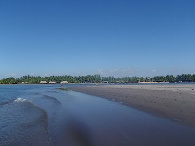
Thanks to several river mouths along the coastal line, Suchitepequez is probably the department with more beautiful beaches in Guatemala. The tide is less impetuous and the sand is finer and lighter.
I would like to be able to share with you interesting and valuable information about other regions in Suchitepequez, but this time, I found myself without so much to say. 
Since the whole area has not been developed yet in terms of tourism, and while living in Guatemala, most of the time I only passed through Mazatenango on my way to some other places, my personal experiences there, are limited. So,instead of writing, today, I invite you to take a look at these images. I hope they  motivate us enough for all of us to visit this pristine region real soon.
 

Wednesday, June 23, 2010

The Mountainous Side of Suchitepequez: Santa Barbara and Los Andes Reserve

This is the municipality of Santa Barbara and I don't exaggerate when I say that what we are going to discover today is a hidden treasure.
Los Andes, a Private Nature Reserve, located on the western chain of Guatemala’s volcanoes, is among the first cloud forests dedicated to the protection of the Resplendent Quetzal (Pharomachrus mocinno), whose courtship and nesting activities attract birdwatchers from around the world to the Reserve.
Los Andes is also home to the rare cabanis tanager (Tangara cabanisi). This small, blue, exquisite bird’s habitat is shared by hundreds of local and migrating species, including a host of hummingbirds, orioles, flycatchers, trogons and motmots.
The Reserve works closely with the residents to promote self sufficiency, health and education and the most important accomplishment is that they are being successful with a method that goes from the traditional education of repetition to an education of understanding, which is clearly reflected in the school’s slogan “Learn, achieve and share”.
The unique biodiversity of the Reserve, including wildlife, has tremendous potential for Eco-tourism and local residents are being trained as guides to provide them with an alternate source of income, and that is why at Los Andes we can enjoy a variety of activities including bird-watching, explorations through the coffee and tea certified sustainable plantations, the botanical garden, and through the cloud forest to admire more than 50 species of exquisite orchids. For the adventurous, Los Andes Reserve also offers a river adventure and hikes to the top of the beautiful Volcano Atitlan.
The core of Los Andes, of course, is The Quetzal Project, an initiative started by Dr. Anne LaBastille back in 1968, when she first visited Los Andes and worked on a Quetzal research project. The result of this was an article published in the January 1969 edition of National Geographic. She also created, in 1972, the first Association in Guatemala dedicated to the conservation of this magnificent bird, making Los Andes the first protected area officially declared in Guatemala for the protection of the Quetzal.
Artificial nest boxes were designed by Dr. LaBastille in an attempt to reduce the mortality of nesting quetzals, whose nest trees and stumps often fall down. The boxes were placed in the cloud forest in safe locations and eventually were accepted and used by a few birds,  a method that is still in use today! This elusive bird can be better observed during  two distinctive seasons,  from November to January and from April to June, which is the nesting season.
Los Andes Nature Reserve certainly is an area in which agricultural production, human development and environmental conservation are carried out in a harmonious and sustainable manner, for the well being of present and future generations.

Recommended Reading:
Lista Comentada De Las Aves De Guatemala / Annotated Checklist of the Birds of Guatemala (English and Spanish Edition)

A detail of Dr. LaBastille work in Guatemala and other parts of Central and South America.

Monday, June 21, 2010

Along the Coastal Road CA-2: Suchitepequez

As you may have noticed, our journey through the coastal plains is taking us from West to East, in a big loop that eventually will take us back to Guatemala City. Our first encounter with the Pacific Ocean was at the Manchon Guamuchal biological reserve, which defined the end of the Highlands and the starting point of the Lowlands.
During the past days, we explored some of the Retalhuleu's attractions and today, we are going to start our journey through the department of Suchitepequez, an indigenous voice that translates as Flowers Hill (I couldn't find the true origin of the name because in addition to Spanish, the Maya origin languages K'iche, Tz'utujil, and Cak'chikel are spoken in this department).
The capital city of this department is Mazatenango, which represents the general conditions of the area: prosperous, modern, self sufficient, and joyful, is better known among Guatemalans for the celebration of Carnaval (Mardi Grass-like celebration), one whole week before the lent season. 
To be honest, the commercial activities are so important for the inhabitants that they have shown very little interest in the natural wealthiness of this department, which by the way, is extraordinarily rich: from tranquil rivers and ponds to the impetuous Pacific Ocean.
For instance, the municipalities of Patulul and San Juan Bautista have abundant creeks and pools along the Madre Vieja River basin, while the municipalities of Santa Barbara, Chicacao, and San Miguel Panan have similar attractions along the Nahualate River.
Almost every one of the Suchitepequez municipalities have natural attractions, and with a few exceptions, most of them don't have the appropriate infrastructure to be considered tourist places, especially for the foreign visitor.Nevertheless, during the next days we will explore the surroundings to discover some of these pristine spots through small towns, rivers, mountains and along the 18 kilometers of fine gray sand beaches. I hope you will join us in this new adventure.
In case you didn't notice, our good friend Maynor Mijangos from galasdeguatemala.com is back. Thank you Maynor for the beautiful images.

Monday, June 7, 2010

From the Green Mountains to the Pacific Lowlands

Enough with the pause! My paisanos are remarkable and unstoppable, so if they manage to get up on their feet right after the storm, literally speaking, we should do the same and continue with our journey; after all, we still have 5 amazing regions to discover!
According to the Inguat's regional classification, the Pacific Lowlands are included in region  No.6: The Exotic and Diverse Pacific Ocean, an area where we will enjoy biological preserves, archaeological sites, recreational theme parks, long stretches of black sand beaches, world-class deep sea sports fishing, impetuous surfing waves, enchanting towns and villages, and probably, much more...
We interrupted our trip last week when we were about to visit Manchon Guamuchal, the transitional area between the highlands and the lowlands of the Pacific Coast, so, Manchon Guamuchal will be today's starting point. This beautiful  Nature Reserve is located between the departments of San Marcos and Retalhuleu.
This wild, 13,500-hectare wetland reserve harbors the last remaining undisturbed mangrove swamps in the country. It is included in the Ramsar Convention on Wetlands, encompassing a list of globally important sites, particularly those that provide habitat for aquatic migratory and resident birds.
Manchon Guamuchal, is also a red and white mangrove forest, which is an important stop along the path of migratory birds coming from Canada and United States of America. Among the species that can be found in the area, are: 14 duck species (12, migratory), sparrow hawks, buzzards, falcons, and around 20 species of egrets. Birds arrive sometime in October to November, leaving in March after wintering in the lagoons. In addition to birds, there are crocodiles, iguanas, and abundant fish.
Despite its natural beauty and even though it is recognized as one of the most complex and productive ecosystems in the world, tourism in Manchon Guamuchal is not formally developed yet; however, there are plenty of activities that can be performed there, including birdwatching and kayaking, and for what I have seen and read, for nature lovers, exploring this area promise to be a rewarding experience.
Bookmark and Share