Today, we are going to travel through the eyes of Norma Monroy, a young Guatemalan civil engineer passionate about soil mechanics, which is a largely studied subject in Guatemala due to the geological and topographical characteristics of the terrain. From time to time, her job requires her to travel around Guatemala, and as she says, this is one of the things she enjoys the most.
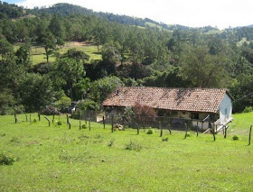
Lucky us, Norma also enjoys photography and for today's post, she is happy to share with all of us some of the images she captured while traveling through Barillas, San Mateo Ixtatan, Nenton, and Jacaltenango.
The Barillas municipality is the hometown of one of our companions' mother, so I do hope he and his family, specially his mother, will enjoy this journey.
As for the information I found, this whole region contains not just important but also beautiful water sources, such as rivers, lagoons, and waterfalls, among others: Maxbal lagoon, Magdalena lagoon and waterfalls, Turtle Lagoon, Yolnabaj (also known as Brava) lagoon, Yulaxac waterfalls, Ixcan river. After the images that I have seen, I am sure that all of these pristine places will make any trip a beyond worthy adventure.
A large extension of this territory is classified as subtropical wet forest with maximum elevations at 1,500m above sea level, which makes it perfect for specialized cultures, such as cardamom, coffee, and vanilla, among others.
Another extension of the territory is classified as mountainous wet forest / cloud forest, with maximum elevations at 2,500m above sea level, where we can find luscious vegetation, extensive conifers forests, and birds, lots of birds, some of them, extraordinary and rare species, including the elusive Resplendent Quetzal, even depicted in this beautiful huipil from San Mateo Ixtatan.


nice pics
ReplyDelete